October 4, 2000
We got ourselves together and got off after breakfast for some biking and birding. We were on our bikes from 8 a.m. to 3 p.m.—28 miles in Sausalito, Corte Madera, Kentfield, Greenbrae, & Ross.
This is a wonderful place for both birding and cycling as there are paved or packed earth bike/hiking trails all through this freshwater, saltwater, SF Bay area. We also walked about 3 miles and biked about an equal number of miles on off-road trails—a bit tricky and jarring for me on my Litespeed touring bike but nothing for Tim on his suspended Breezer or Jess on her suspended Trek 8500.

At our first stop in a marshy area, we saw willits, black-necked stilts, western grebes, marbled godwits, greater yellowlegs, 5 white pelicans (in a circle, wings outstretched, "herding" the fish into an ever smaller corral), great and snowy egrets, and "peeps" flashing their white bellies in perfect formation—probably sanderlings or some small sandpipers. Also saw mallards, coots, and Caspian terns, the latter on a log raft opposite Tim's houseboat. Can't remember whether it was this day or the next when a harbor seal swam curiously around Tim's front deck.
We explored by foot and bike the base of Mount Tamalpais (Mt Tam as the locals call it), explored some houseboat docks quite apart from those in Tim's area, and stopped for lunch at a little sushi cafe with outdoor tables.
 |
| Susan with Mount Tam in the background |
In the Ross area (where Sean Penn has just built a house) we marveled at the huge old beautiful houses that Tim tells us sell for 10 to 22 million dollars. The garden house in one was larger than our house in Stillwater. We toured the College of Marin where Jess takes her cello lessons and plays with a chamber group and where her friend Carolyn teaches ESL.
When we got back, Jess had to run to a first aid class to certify for her kayaking job, so Tim and I went by car along the Sausalito waterfront and explored Fort Baker (a coast guard base and water rescue station as well as housing the Marin Rowing Association) at the northeastern foot of the Golden Gate Bridge.
Then we climbed the headlands on the northwest side of the bridge. What an astounding area. Very high. Many racing cyclists cycling up and sailing down this steep and challenging area. The whole of SF and Richmond can be seen through the golden orange bridge stringers—it appears as a Greek city, beautifully white and clean looking, Alcatraz standing out in the bay and Angel Island on the near side.
 |
| Steep road and headlands; below gun emplacements and the view of San Francisco through the Golden Gate Bridge |
Finally came down the other side on a very steep one-way road (gulp) to a spot overlooking Point Bonita and the lighthouse. Here we watched brown pelicans sail by nearly at eye level. They are fantastic flyers and very beautiful to watch. I preferred watching them to watching the Blue Angels that flew loops and formations over us the following day on our way across the Golden Gate and into the city.
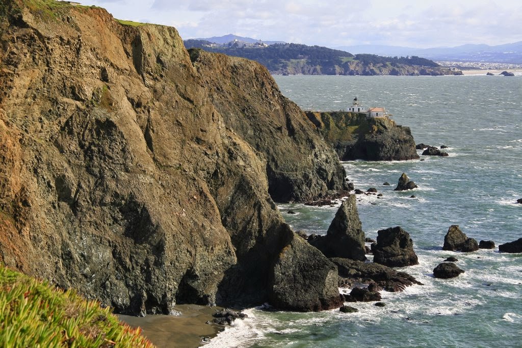 |
| Internet photo of Point Bonita Lighthouse from the Marin Headlands |
This whole headlands area (part of the Golden Gate Recreation Area) has only recently been opened to the public. It was a military installation with cream colored, red-tile roofed buildings like those in the Presidio. All of these military buildings have now been converted to YMCA camps, hostels, museums, and schools. The tunnels through the mountain and the storage tunnels and gun emplacements are still there, however.
Met Jess and the three of us went to Whole Foods to make ourselves big take-home salads. An early night as Jess and I cannot shake the sleepies at 8:30 or 9 or so.
Miles: 28
No comments:
Post a Comment